Menu


error This forum is not active, and new posts may not be made in it.
PromoteFacebookTwitter!
Luis Miguel Goitizolo

1162
61587 Posts
61587
Invite Me as a Friend
Top 25 Poster
Person Of The Week
RE: ARE WE NOW IN THE END TIMES?
9/11/2018 11:36:27 PM

In rare event, Atlantic, Pacific churn with storms at same time

Storms in the northeast Pacific have generated the most 'accumulated cyclone energy' on record for the season thus far.
by Dennis Romero /


Hurricane Florence seen over the Atlantic Ocean, about 750 miles southeast of Bermuda on Sept. 9, 2018.
NOAA NWS National Hurricane Center via Reuters


As forecasters predicted an increased likelihood that Tropical Storm Florence could strengthen and strike somewhere along the East Coast, some experts said it was another symptom of a historic and unique hurricane season that could be influenced by global warming.

With the Eastern Seaboard on alert, storms in the northeast Pacific Ocean have generated the most "accumulated cyclone energy" on record through the first week September, said Phil Klotzbach, an atmospheric science researcher at Colorado State University.

Usually when the Pacific is alive with storm energy the Atlantic Ocean is not. The synergistic high and low activity modes are well known to scientists, and this was supposed to be the Pacific’s year to make waves.

And then Florence came along.

“The thing that’s interesting now is the Pacific is still active, but the Atlantic is very active, which isn’t normal,” Klotzbach said. “I’m surprised to see the Pacific and Atlantic active at the same time.”

The researcher said this happened to a lesser extent in 2016, but notes that this time around the Atlantic is displaying unusual fury after being slated for relative hibernation.

There have been nine named storms in the Atlantic — above average for the period — and 15 in the Pacific since their hurricane seasons began on June 1 and May 15, respectively, Klotzbach said.

Since 1970, the northeast Pacific and Atlantic have had above-average accumulated cyclone energy in the same year only twice — in 1998 and 2016, Klotzbach said via email.

It may be too soon to blame climate change for the anomalous weather. But experts say there are correlations between what’s happening in the seas off the United States and what global warming has been doing for years — heating up the waters.
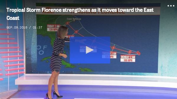
Warming waters are fueling more powerful and more destructive storms, which have generally eluded the United States so far this season, climate researchers say.

“We do know these changes are happening,” said Kristy Dahl, a senior climate scientist at the Union of Concerned Scientists. “There is at least a hypothetical connection between hurricanes and warming ocean temperatures."

It’s not clear, she added, “how much is being caused by humans and how much is just natural variability.”

But what weather watchers are seeing in the Atlantic and Pacific is “consistent with climate change,” Dahl said.

Forecasters said Florence is expected to become a Category 3 hurricane by Monday, and Klotzbach has noted that a new tropical depression, since named Helene, has formed in the eastern portion of the Atlantic.

Meanwhile in the Pacific, record warm waters along the coast of Southern California and beyond are seen as a prelude to an El Niño weather pattern in winter that sometimes includes higher-than-normal rainfall, experts say.

El Niño years usually go hand-in-hand with mild hurricane seasons in the Atlantic and active ones in the Pacific. But not this year. “Warming waters could exacerbate the issue” of hurricanes in the Pacific, Klotzbach said.

In August, Hurricane Lane in the central Pacific reached top power to Category 5 but weakened to a tropical storm by the time it brushed by the Hawaiian islands. Still, it dumped 40 inches of rain on the Big Island and caused flood damage throughout the island chain.

On Friday, Hurricane Olivia created sustained winds of 100 mph and was headed in the general direction of the Hawaiian islands, according to the Central Pacific Hurricane Center.

Dennis Feltgen, a meteorologist at the National Hurricane Center in Miami, is skeptical of the argument that the dual-ocean upheaval is rare.

He pointed out that the Atlantic and the Pacific are living up to the National Oceanic and Atmospheric Administration’s outlook for the season: near or below-average action in the Atlantic, with nine to 13 named storms, and near or above-average output in the Pacific, with 14 to 20 named storms.

It’s “not at all unusual,” Feltgen said via email.

However, with the Pacific season only halfway through — it runs roughly from June 1 through Dec. 1 — it has already reached the low end of the National Hurricane Center’s prediction.

“We’re busy trying to figure out what’s happening in the Pacific, particularly in the central Pacific,” which is a hub of storm activity, said Peter Donaldson, a forecaster with the Central Pacific Hurricane Center.

“The season is not over, but we can already say that’s a pretty high number,” he said.

The saving grace of an active hurricane season in the Pacific is that the ocean is vast and humanity is virtually a needle in a haystack, often resulting in fewer deaths and less damage in the United States and its territories than when the Atlantic kicks up, Donaldson said.

Conditions, including warmer water farther north than in the past, are nonetheless ripe for more storms with more power.

“It’s been a busy season,” Donaldson said. “Whether it will be a record-breaking season, it’s too early to say.”


(
nbcnews.com)


"Choose a job you love and you will not have to work a day in your life" (Confucius)

+1
Luis Miguel Goitizolo

1162
61587 Posts
61587
Invite Me as a Friend
Top 25 Poster
Person Of The Week
RE: ARE WE NOW IN THE END TIMES?
9/12/2018 10:52:56 AM

Parts of South Africa blanketed in snow, roads and mountain passes closed

Posted by on

Most of South Africa's Western Cape was blanketed in snow over the weekend, causing temporary road closures and providing a new and snowy environment to animals not used to such wintry conditions.

Temperatures in Western Cape dropped so low it resulted in a blanket of snow covering areas in the Matroosberg Reserve, Cederberg and Hex River Mountains. Some snow could still be seen on Sunday, September 9 but most of the ground snow in the Matroosberg area had melted away, CapeTownEtc reports.


Another of @kitty Viljoen s incredible snaps.
Asantasana Game Farm outside Graaff Reinet, Eastern Cape, South Africa.

1,6 mil
161
2,9 mil

Featured image credit: Kitty Viljoen


(THE WATCHERS)


"Choose a job you love and you will not have to work a day in your life" (Confucius)

+1
Luis Miguel Goitizolo

1162
61587 Posts
61587
Invite Me as a Friend
Top 25 Poster
Person Of The Week
RE: ARE WE NOW IN THE END TIMES?
9/12/2018 8:46:05 PM

Hurricane and storm surge warnings issued, more than 1.5 million evacuated as extremely dangerous Hurricane "Florence" eyes Carolinas

Posted by on

The National Weather Service has issued hurricane and storm surge warnings for portions of the coasts of North and South Carolina on September 11, 2018, as extremely dangerous Hurricane "Florence" continues heading toward the East Coast U.S. Landfall is expected between northern South Carolina and North Carolina's Outer Banks on September 13. Florence could linger over the Southeast for several days after landfall, leading to catastrophic flash flooding and major river flooding in parts of the Carolinas, Virginia and neighboring states.

Governors of Maryland, Virginia, North Carolina and South Carolina have declared states of emergency ahead of the storm and more than 1.5 million people have already evacuated coastal areas.

Computer-model forecasts generally project Florence to make landfall between northern South Carolina and North Carolina’s Outer Banks as a Category 4 Hurricane on Thursday, September 13.

While shifts in the track are still possible, storm impacts will expand great distances beyond where landfall occurs and there is a potential for Florence's forward speed to slow and possibly stall, leading to more than 500 mm (20 inches) of rainfall on some of the already saturated ground which would lead to catastrophic flash flooding and major river flooding in parts of the Carolinas, Virginia and other neighboring states.

If Florence makes landfall as a Category 4 in North Carolina, it would be the strongest storm to come ashore that far north on record.

Hurricane "Florence" as seen from ISS on September 10, 2018. Credit: NASA/ISS

In general, most of hurricane damage and loss of life occurs not on the coast, but from flooding as the result of heavy rain. In all likelihood, this will be the case with Hurricane Florence as well, according to AccuWeather President and Founder Dr. Joel N. Myers.

"There could be devastating floods well in from the coast back in the hills and mountains of North Carolina, Virginia and West Virginia," Myers said.

"There’s never been a storm like Florence," AccuWeather Vice President of Forecasting and Graphics Operations Marshall Moss said. "It was located father north in the Atlantic than any other storm to ever hit the Carolinas, so what we’re forecasting is unprecedented. Also, most storms coming into the Carolinas tend to move northward, and this storm looks like it’s going to stall over the region and potentially bring tremendous, life-threatening flooding."

At 09:00 UTC on September 11, the center of Hurricane "Florence" was located about 660 km (410 miles) S out Bermuda and 1 570 km (975 miles) ESE of Cape Fear, North Carolina. Its maximum sustained winds were 220 km/h (140 mph), making it a Category 4 hurricane on the Saffir-Simpson scale. The storm was moving WNW at 24 km/h (15 mph) with minimum central pressure 944 hPa.

A Storm Surge Watch is in effect for Edisto Beach, South Carolina to the North Carolina-Virginia border, Albemarle and Pamlico Sounds, including the Neuse and Pamlico Rivers. A Storm Surge Watch means there is a possibility of life-threatening inundation, from rising water moving inland from the coastline, in the indicated locations during the next 48 hours.

A Hurricane Watch is in effect for Edisto Beach, South Carolina to the North Carolina-Virginia border, Albemarle and Pamlico Sounds. A Hurricane Watch means that hurricane conditions are possible within the watch area. A watch is typically issued 48 hours before the anticipated first occurrence of tropical-storm-force winds, conditions that make outside preparations difficult or dangerous.

Florence will hit the region which received 150 to 300% of its normal rainfall since May.

Interests elsewhere in the southeastern and mid-Atlantic states should monitor the progress of Florence, NHC said, adding that additional watches may be required later today.

The combination of a dangerous storm surge and the tide will cause normally dry areas near the coast to be flooded by rising waters moving inland from the shoreline. The water has the potential to reach the following heights above ground if peak surge occurs at the time of high tide:

  • Edisto Beach to Murrells Inlet: 60 - 120 cm (2 - 4 feet)
  • Murrells Inlet to Cape Fear: 120 to 180 cm (4 - 6 feet)
  • Cape Fear to Cape Lookout, including The Neuse and Pamlico River: 180 to 360 cm (6 - 12 feet)
  • Cape Lookout to Ocracoke Inlet: 150 to 240 cm (5 - 8 feet)
  • Ocracoke Inlet to North Carolina/Virginia Border: 90 to 150 cm (3 - 5 feet)

The deepest water will occur along the immediate coast in areas of onshore winds, where the surge will be accompanied by large and destructive waves. Surge-related flooding depends on the relative timing of the surge and the tidal cycle, and can vary greatly over short distances.

Florence is expected to produce total rainfall accumulations of 381 to 508 mm (15 to 20 inches) with isolated maxima to 762 mm (30 inches) near Florence's track over portions of North Carolina, Virginia, and northern South Carolina through Saturday, September 15. This rainfall may produce life-threatening flash flooding.

Hurricane conditions are possible within the watch area by late Thursday or Thursday night, September 13, with tropical storm conditions possible by Thursday morning.

Swells generated by Florence are affecting Bermuda and portions of the U.S. East Coast. These swells are likely to cause life-threatening surf and rip current conditions.

Featured image credit: NASA/ISS


(THE WATCHERS)


"Choose a job you love and you will not have to work a day in your life" (Confucius)

+1
Luis Miguel Goitizolo

1162
61587 Posts
61587
Invite Me as a Friend
Top 25 Poster
Person Of The Week
RE: ARE WE NOW IN THE END TIMES?
9/12/2018 8:57:21 PM

Mangkhut becomes 4th Super Typhoon of the 2018 season, heading toward Philippines, Taiwan and Hong Kong

Posted by on

Typhoon "Mangkhut" underwent rapid intensification and became the fourth Super Typhoon of the 2018 Pacific typhoon season on September 11, 2018. The system is currently slowing down while maintaining its westerly track across the Western Pacific Ocean and it expected to further intensify over the next two days. The current forecast track takes its center just north of northern Philippines on September 14, south of Taiwan on September 15 and then toward Hong Kong. Landfall is expected just south of the territory around 12:00 UTC on September 16. This is the 22nd named storm of the 2018 Pacific season.

At 15:00 UTC on September 11, the center of Super Typhoon "Mangkhut" was located approximately 470 km (292 miles) north of Yap, Federated States of Micronesia and has tracked westward at 22 km/h (14 mph) over the past six hours.

Animated enhanced infrared satellite imagery shows a symmetric and highly consolidated system with compact feeder bands spiraling tightly into a sharply-outlined 42 km (26 miles) wide eye.

Mangkhut is forecast to track WNW after 21:00 UTC today and continue strengthening to a peak of 278 km/h (278 mph) by 03:00 UTC on September 13. The system will slightly weaken by 15:00 UTC on September 14 as it approaches Northern Luzon and pass just north of its northern tip during the day.

The current forecast track takes its center south of Taiwan by 12:00 UTC on September 15 and just south of Hong Kong by 12:00 UTC on September 16.

PAGASA expects the typhoon to enter the Philippine Area of Responsibility (PAR) during the afternoon hours of September 12 (LT) when it will name it "Ompong."

Tropical Cyclone Warning Signal (TCWS) #1 may be raised as early as tomorrow evening local time, the agency said.

The typhoon may strengthen the Southwest Monsoon bringing scattered light to moderate rains and thunderstorms over the Zamboanga Peninsula, Western Visayas and Palawan starting September 13.

Featured image: Super Typhoon "Mangkhut" at 18:50 UTC on September 11, 2018. Credit: JMA/Himawari-8, RAMMB/CIRA


(THE WATCHERS)


"Choose a job you love and you will not have to work a day in your life" (Confucius)

+1
Luis Miguel Goitizolo

1162
61587 Posts
61587
Invite Me as a Friend
Top 25 Poster
Person Of The Week
RE: ARE WE NOW IN THE END TIMES?
9/12/2018 10:51:01 PM

Russia launches biggest ever war games involving China


  • CHITA, Russia — Sep 11, 2018, 3:39 PM ET


    In this photo taken from video provided by Russian Defense Ministry Press Service on Tuesday, Sept. 11, 2018, tanks roll during the military exercises in the Chita region, Eastern Siberia, during the Vostok 2018 exercises in Russia. Russia's military chief of staff says that the military exercises expected to be the biggest in three decades, will involve nearly 300,000 troops. (Russian Defense Ministry Press Service pool photo via AP)


    Hundreds of thousands Russian troops swept across Siberia on Tuesday in the nation's largest ever war games also joined by China — a powerful show of burgeoning military ties between Moscow and Beijing amid their tensions with the U.S.

    Moscow said the weeklong Vostok (East) 2018 maneuvers will span vast expanses of Siberia and the Far East, the Arctic and the Pacific Oceans and involve nearly 300,000 Russian troops — nearly one-third of the country's 1-million-strong military. They will feature more than 1,000 aircraft, about 36,000 tanks and other military vehicles and 80 warships.

    Russian Defense Minister Sergei Shoigu has described the drills as even bigger than the country's largest Cold War-era exercise called Zapad 1981 that put NATO allies on edge.

    A retired Russian general said that the giant war games come as a warning to the U.S. against ramping up pressure on Russia.

    "The maneuvers are aimed at deterring the aggressive intentions of the U.S. and NATO," Ret. Gen. Leonid Ivashov said. He was quoted by the Interfax news agency as saying that the drills are "also a response to the U.S. sanctions."

    China is sending about 3,200 troops, 900 combat vehicles and 30 aircraft to join the drills at a Siberian firing range, a significant deployment that reflects its shift toward a full-fledged military alliance with Russia. Mongolia also has sent a military contingent.

    Asked if the U.S. is worried about a possible military alliance between Russia and China, Defense Secretary Jim Mattis told Pentagon reporters Tuesday that, "I think that nations act out of their interests. I see little in the long term that aligns Russia and China."

    As the maneuvers kicked off, Chinese President Xi Jinping visited Russia on Tuesday to attend an economic forum in Vladivostok. President Vladimir Putin treated Xi to pancakes with caviar and shots of vodka in a show of their warm rapport.

    Moscow and Beijing have forged what they described as a "strategic partnership," expressing their shared opposition to the "unipolar" world, the term they use to describe perceived U.S. global domination. However, the military drills they had until now were far smaller in scale, reflecting China's caution about alliances.

    Some experts pointed out that the U.S. helped spawn closer Russia-China military ties by labeling them strategic competitors.

    "They feel they need to embrace to deal with the increasingly high pressure and containment from the U.S.," said Yue Gang, a military expert and retired Chinese army colonel.

    He noted that China feels that the Washington's hostile attitude and actions, such as deploying the THAAD missile defense system in South Korea, relieve it of any need to take U.S. views into consideration when deepening strategic trust with Moscow.

    "The war games have laid a foundation for China and Russia to enhance cooperation on international arena and will lift the combat proficiency of both sides," he said.

    The Chinese media touted the Chinese involvement in the maneuvers as the country's largest-ever dispatch of forces abroad for war games.

    Some noted that the People's Liberation Army, which hasn't fought a war since the attempted invasion of Vietnam in 1979, is keen to learn from Russia's experience in the Syrian campaign, where it tested its latest weapons and tactics.

    From China's perspective, the emerging military alliance with Russia sends a strong signal to the U.S. and its ally Japan as Beijing moves to defend its interests in the South China Sea, which China claims virtually in its entirety, as well as Taiwan and the Senkaku and Diaoyu islands controlled by Japan but claimed by Beijing.

    Hong Kong-based commentator Song Zhongping said China is anxious to acquire more experience in large-scale operations that might become a factor in a conflict with the U.S. and others over territorial claims in Asia.

    "Russia has very strong real combat abilities and the participation of the PLA in such a large-scale military exercise that is specially tailored for an anti-invasion war indicates China's intention to learn more valuable combat practices and lift its ability for joint combat," Song said.

    For Russia, the increasingly robust alliance with China is particularly important amid the growing tensions with the U.S. and its allies and a looming threat of more biting U.S. sanctions.

    "The scale and the scenario of those drills are in line with the current military-political situation," said Ivashov, the retired Russian general. "They demonstrate the seriousness of our intentions."

    The U.S. and its NATO allies are closely eyeing the exercises for what they reveal about military cooperation between Russia and China and their mounting military might.

    "We're obviously aware of it, we're watching it closely," said Army Col. Rob Manning, a Pentagon spokesman. "We're aware of Russia's right to sovereignty and to exercise in order to ensure their readiness."

    NATO Spokeswoman Oana Lungescu said that the training "fits into a pattern we have seen over some time: a more assertive Russia, significantly increasing its defense budget and its military presence."

    She also noted that "China has growing military capabilities and is playing an increasingly significant global role," adding that "it's important for NATO to engage with China."

    ———

    Vladimir Isachenkov reported from Moscow. Christopher Bodeen in Beijing, Lolita C. Baldor in Washington and Lorne Cook in Brussels, contributed to this report.


    (abcnews.go.com)

    "Choose a job you love and you will not have to work a day in your life" (Confucius)

    +1


    facebook
    Like us on Facebook!